
Los Burros Trail #631
Arizona's White Mountains
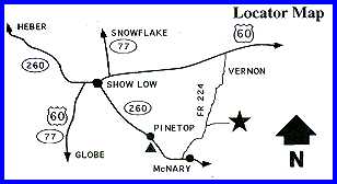
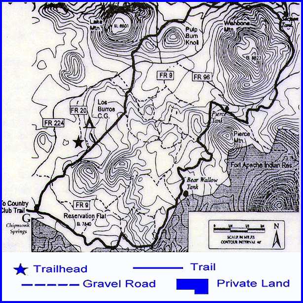
Attractions and Considerations: Los Burros covers more than ten miles of mixed conifer and ponderosa pine forest. This is an ideal trail to take during the hottest days of summer because of the high altitude and many sections of the trail are shaded. A side trip to Lake Mountain Lookout can give you a wonderful view of the area. Keep in mind that these towers are manned during the peak fire season. Visitors are welcome, but lookouts may refuse visitors if they are busy. Nature observation can be very rewarding along this trail. The mixed conifer forest contains varieties of spruce, pine, and fir as well as aspen and oak. Elk and mule deer are commonly sighted along with an occasional black bear. Notice how many aspen trees show the claw marks of bears. The section of trail between FR 96 and FR 9 is particularly beautiful and Reservation Flat makes an ideal spot for lunch or a short break. On a clear day it's possible to see Flagstaff's San Francisco Peaks (Arizona's highest point, 100 miles away) from the northwest slopes of Wishbone Mountain. Access and trailhead location: The trailhead is located at Los Burros Campground. From Lakeside, take AZ 260 to McNary on the White Mountain Apache Reservation. In McNary, turn left on FR 224, following signs to Vernon. Drive approximately 8 miles until road signs direct you to turn right into Los Burros Campground. Drive to the far end of the campground to find the trailhead.
Click here
for topographical map!
Return to White Mountain TrailSystems Overview Page White Mountain Trail Systems / White Mountain Maps For more information, please feel free to contact:
White Mountains Online wishes to express our appreciation to the USDA Forest Service, Lakeside District and the Town of Pinetop-Lakeside for providing this information! |
|||||||||||||