|
 Apache
County was carved from Yavapai County — one Arizona's original four
counties — on February 24, 1879, by the 10th Territorial Legislative
Assembly. Leaders of St. Johns and Globe had petitioned for their towns to be
the county seat, but the honor went temporarily to Snowflake, with the
provision that an election would determine the permanent county seat. In
November 1879, on the strength of votes from the mining town of Clifton (now in
Greenlee County), St. Johns was designated the county seat. Apache
County was carved from Yavapai County — one Arizona's original four
counties — on February 24, 1879, by the 10th Territorial Legislative
Assembly. Leaders of St. Johns and Globe had petitioned for their towns to be
the county seat, but the honor went temporarily to Snowflake, with the
provision that an election would determine the permanent county seat. In
November 1879, on the strength of votes from the mining town of Clifton (now in
Greenlee County), St. Johns was designated the county seat.
Originally,
Apache County encompassed all of present day Navajo County, part of Gila County
and part of Graham County, but by 1895 its size had been reduced to the 11,216
square miles it occupies today. The Apache and Navajo Indian reservations cover
more than 65.4 percent of the county, and 25 percent of the state's Native
Americans live here. Approximately 21 percent is public land, and 13.2 percent
is privately owned. All of Apache County is an Enterprise Zone.
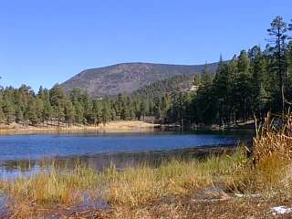
The
forested White Mountains and green pastures in the south of the county contrast
sharply with the high, dry, colorful plateau region of the north. Excellent
fishing, hunting and skiing make the White Mountains a year-round recreation
area. Numerous archaeological sites are open to the public.
Fort
Defiance, Arizona's first military post, the Town of Ganado, and Hubbell's
famous trading post (now a National Historic Site) are located in northern
Apache County on the Navajo Reservation. Chinle, another Indian trade center,
is the gateway to the spectacular Canyon de Chelly National Monument. Also in
Apache County are the spectacular Petrified Forest National Park and the
Painted Desert, Window Rock, the Navajo tribal capital, and Casa Malpais
Archaeological site. The Apache Indian Reservation, located in the White
Mountains around the settlement of Fort Apache, includes 25 excellent fishing
lakes and the Sunrise park Ski Resort for outdoor recreation, as well as a
highly successful lumber mill and a casino.
|
At-A-Glance:
- County
Seat: St. Johns
- Population:
73,775 as of 2006
- Labor
Force: 19,995
- Unemployment
Rate: 10.0%
- Major
Industries: Services, Retail Trade, Transportation/Public Utilities
- Best
Paying Industries: Transportation/Public Utilities, Services, Wholesale
Trade.
|
|
Population |
|
| |
1980 |
1990 |
2000 |
2005 |
| Arizona |
2,716,546 |
3,665,228 |
5,130,632 |
6,044,985 |
| Apache County |
52,108 |
61,591 |
69,423 |
73,775 |
| Major Cities/Communities: |
|
|
|
|
| Chinle, Navajo Nation |
4,893 |
7,000 |
5,366 |
12,743 |
| Eagar |
2,791 |
4,025 |
4,033 |
4,435 |
| St. Johns |
3,368 |
3,294 |
3,269 |
3,865 |
| Springerville |
1,452 |
1,802 |
1,972 |
2,065 |
| Window Rock/Fort Defiance, Navajo Nation |
N/A |
7,795 |
7,120 |
2,859 |
| |
|
|
|
|
| New Lands (local estimate) |
1,125 |
1,500 |
1,452 |
N/A |
Source U.S. Census Bureau April 1, 2000 Census |
|
|
|
|
SCENIC ATTRACTIONS
 Four
rivers lie in the forest,
including the Black, Little Colorado, the Blue and the San Francisco.
Elevations in the forest range from 3,500' to the 11,590' summit of Mt. Baldy
on the White Mountain Apache Indian Reservation. There are Prehistoric Cliff
Dwellings, Scenic Meadows, Ghost Towns, Mining Communities and Scenic Mountain
Drives. Sunrise Ski & Recreation Park, owned by the White Mountain Apache
Tribe, is located 20 miles southwest of Eagar. It offers skiing, sledding, and
sight seeing activities for year round recreation. Alpine and Greer, each
approximately 20 miles south of Eagar, have three supervised cross-country ski
trails of varying difficulty. Four
rivers lie in the forest,
including the Black, Little Colorado, the Blue and the San Francisco.
Elevations in the forest range from 3,500' to the 11,590' summit of Mt. Baldy
on the White Mountain Apache Indian Reservation. There are Prehistoric Cliff
Dwellings, Scenic Meadows, Ghost Towns, Mining Communities and Scenic Mountain
Drives. Sunrise Ski & Recreation Park, owned by the White Mountain Apache
Tribe, is located 20 miles southwest of Eagar. It offers skiing, sledding, and
sight seeing activities for year round recreation. Alpine and Greer, each
approximately 20 miles south of Eagar, have three supervised cross-country ski
trails of varying difficulty.
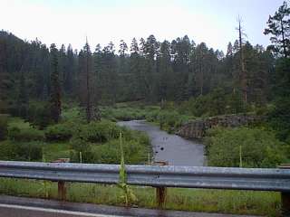
U.S. Highway 180-191 has been
officially designated "Coronado Trail." The historic and scenic qualities of
this route will enhance any motorist's enjoyment of the area. The Little
Colorado River originates in Greer 14 miles west and flows through Eagar on its
way north and west to the Grand Canyon. Along the river are deer, antelope,
small game, and birds. It is considered one of the better duck hunting areas in
the state.
The shortest and most scenic route from Phoenix to
Albuquerque is through St. Johns, which is surrounded by tourist and visitor
destinations. There are many archaeological sites in the area. Of particular
interest, are the Prehistoric Dwellings, Petroglyph Trails and Archaeological
Programs for excavation opportunities. Recently an archaeological corridor was
completed. The Blue Hills, about three miles north of St. Johns, have
interesting formations (layers) of blue, red and white painted desert clay.
Agate beds and dinosaur teeth have been found in the vicinity.
Community Facilities
 In Apache County, a broad range of community facilities
including museums, Olympic-size pools, tennis and racquetball courts, parks,
libraries, and athletic facilities are at the school/community gym.
Football/Baseball fields, and several parks are available in any of the towns. In Apache County, a broad range of community facilities
including museums, Olympic-size pools, tennis and racquetball courts, parks,
libraries, and athletic facilities are at the school/community gym.
Football/Baseball fields, and several parks are available in any of the towns.
In Eagar, an $11 million multi-purpose domed facility, with 5,000
fixed seats and up to 10,000 movable seats, was completed in 1992 and is the
scene for numerous activities including high school sports, concerts, etc. The
Cushman Art Collection, Lighted Tennis Courts, Downtown Mini Park, City Parks
including the Historic Park are offered in this county.
Becker Lake ( two miles) has a
long history as one of the southwest's best Trout producers.
Lyman Lake State Park (17
miles northwest on U.S. 180) offers fishing, swimming, boating, water skiing,
camping, buffalo, Indian Petroglyphs, and picnic facilities. Nearby
recreational areas include Concho
Lake and Annual events include Buffalo Daze, San Juan Fiesta, Fourth of
July Celebrations, and Pioneer Days.
Springerville offers a variety of accommodations (motels,
cabins, trailer parks and campgrounds) to suit visitors needs. Complete
shopping and professional services are also available. Springerville is the
nearest full-service community to the Apache Sunrise Ski Resort, that is owned
and operated by the White Mountain Apache Tribe (26 miles southwest). Sunrise
offers ski programs for all ages and more than 60 trails at an elevation of up
to 11,000-feet.
The communities of
Alpine (20 miles southeast) and
Greer (17 miles southwest) offers Cross
Country Ski Trails, along with Sledding, Snowmobiling, and other winter
recreation. Apache County's proximity to the Blue Range Wilderness Area, three
Indian Reservations, Petrified Forest, Gila National Forest, Indian
Petroglyphs, and Volcanic Formations offer a myriad of day-trip possibilities
form nearby towns.
COMMUNICATION
In addition to the communication resources from the
rest of the state, Springerville, Eagar, and St. Johns have local area
Bi-weekly newspapers, local radio stations and stations received from all
around the area. Several television stations are received (some are via cable)
and there is usually access to cable/satellite reception.
EDUCATION
Dine (formerly Navajo Community College) : Chinle,
Ganado, Tsaile, Window Rock
Northland Pioneer College: Springerville,
St. Johns
MEDICAL
Major Hospitals:
Sage Memorial Hospital,
Ganado
White Mountains Community Hospital, Springerville
Employment by Sector:
|
Manufacturing 625
Construction 550
Transportation,
Communication & Utilities 1,850
Trade 1,700
Finance, Insurance
& Real Estate 775
Other Private Service-Providing 3,800
Services
& Miscellaneous 2,975
Government 12,975
|
Major Employers:
- Ft. Defiance Hospital, Ft. Defiance. (health services)
- Indian Health Services, Chinle/Ft. Defiance. (health
services)
- Navajo Communications Co., Window Rock (telephone
communications)
- Navajo Nation, Window Rock (governmental)
- Navajo Tribal Utility Authority, Navajo Nation (utility)
- P&M Coal Co, Window Rock (mining)
- Packard-Hughes Interconnect, Ft. Defiance (electric equipment
& supplies
- Sage Memorial Hospital, Ganado (health services)
- Salt River Project Coronado Generating Station (power)
- Tucson Electric Power, Springerville (power)
- White Mountain Community Hospital, Springerville (health
services)
Utilities
|
Electric Service |
Natural Gas |
Water & Sewer |
Navajo Tribal Utility Authority
Navopache Electric
Cooperative, Inc. |
Ferrell Propane
Graves Propane
Sierra
Propane
Navajo Tribal Utility Authority |
Navajo Tribal Utility Authority. |
TRANSPORTATION
Interstate 40, U.S. 60, U.S. 160, U.S. 180, U.S. 191, state
Highway 61, state Highway 180A, state Highway 260, state Highway 261, state
Highway 262, state Highway 264, state Highway 273, Indian Route 7, Indian Route
12, Indian Route 54, Indian Route 59, Indian Route 63.
Bus Lines:
include Greyhound Bus Lines, Navajo Transit System, White Mountain Passenger
Lines.
Rail Service: Burlington Northern Santa Fe
Railway
Trucking Service: Alpine Trucking Inc. and JC
Trucking.
Air Service: Navajo Air Transportation (use - public),
Springerville Airport (use - public), St. Johns Airpark (use - public)
INDUSTRIAL FACILITIES
Chinle: There is one 30-acre industrial park with
electricity, gas, water, sewer and transportation services available. Eighteen
of those 30 acres are available for lease. Contact the Industrial Development
Unit- Project Development at (928) 871-6968
Springerville/Eagar:
Springerville has developed an industrial airpark, adjoining the
Springerville Municipal Airport. There are also 221.67 acres available with
some utilities. For more information, contact the Apache County Economic
Security Corporation (ACES) at (928) 337-2644 or the Round Valley Chamber of
Commerce (928) 333-2123.
New Lands: The New Lands is a planned
community administered by the Office of Navajo-Hopi Indian Relocation. For more
information call (928) 688-2413.
St. Johns: Adjoining the
airport, an 80-acre industrial park has available sites to suit
commercial/industrial purposes. Existing infrastructure includes utilities and
paved streets. For more information, contact the Economic Development for
Apache County Corporation (EDAC) at (928) 337-2644.
Window Rock/Fort
Defiance The Fort Defiance Industrial Site, one of seven industrial sites
on the Navajo nation is located at the intersection of Navajo Route 12 and
Navajo Route 54, 30 miles north of I-40. It has 28 acres with utilities and a
paved access road. Contact the Navajo Nation Project Development at (928)
871-6544.
Commercial Banks
Bank One, First Interstate Bank, Frontier State Bank, National
Bank of Arizona, Norwest Bank, Wells Fargo Bank.
Taxes
|
Corporate Income Tax
Effective January 1, 2001,
the corporate income tax rate is 6.968 percent or $50, whichever is
greater. |
Payroll Tax
Payroll taxes in Arizona are computed
based on federal filing by employers and employees. Generally, withholding for
state payroll taxes is between 10 and 32 percent of federal withholding based
on employees' income. |
|
Sales Tax
Effective July 1, 2001, the state
imposes a 5.6 percent transaction privilege (sales) tax on most business
activities. Apache County has a ½ cent general sales tax. St. Johns has
a 2 percent sales tax. Springerville and Eagar have a 3 percent sales tax and
an additional 1 percent and 3 percent tax respectively on hotel and motel
stays.
The Navajo Nation does not have income or Sales Taxes yet.
However, the Nation does impose tax on the sale of Tobacco and also on the sale
of Gasoline. These taxes are collected by the state of Arizona and then
transferred to the Navajo Nation. |
Property Tax
| Community |
School District |
Total Outside City |
City/Fire |
Total |
| Eagar |
4.0700 |
N/A |
N/A |
N/A |
| St. Johns |
4.5400 |
N/A |
0.0000 |
7.3300 |
| Springerville |
4.0700 |
N/A |
0.0000 |
6.8600 |
Source: Arizona Tax Research Foundation, 2000 (Rate is per
$100 of assessed value). Note: Property tax in Arizona is based on assessed
valuation which is 10 percent of market value for residential property.
|
For further information, contact:
City of St. Johns (928)
337-4517, www.stjohnsaz.com
Dineh Cooperatives, Inc. (928)
674-3411
Economic Development for Apache County Corporation (EDAC) (928)
337-2644
Town of Eagar (928) 333-4128
The Navajo Nation, Division of
Economic Development (928) 871-6544
Office of Navajo & Hopi Relocation -
New Lands Office (928) 688-2413
Town of Springerville (928) 333-2656
St.
Johns Regional Chamber of Commerce (928) 337-2000
Round Valley Chamber of
Commerce (928) 333-2123
All information courtesy Arizona Department of Commerce. Updated
December 7, 2001
|