Arizona's White Mountains
Apache-Sitgreaves National Forest
White Mountains Online wishes to express
our appreciation to the USDA Forest Service, Alpine Ranger District for
providing this information!
For more information, please feel free to
contact the USDA Forest Service, Alpine Ranger District at 520.339.4384 or you
may write us at P.O. Box 469 Alpine, Arizona 85920
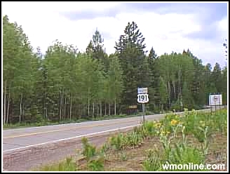
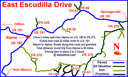
Route:
Drive 2 miles east
from Alpine on U.S. 180 to FR 275. Follow this road 22 miles north to U.S. 191
(formerly U.S. 666) and return to Alpine.
 |
Features:
- Old
fire area healing naturally
- Plentiful wildlife
Facilities:
- Lodging, gas, restaurants in
Alpine
|
Notes:
Roads along this
route are graveled and suitable for passenger cars in all but the worst
weather. Total distance round trip from Alpine is 40 miles. Driving time is
about 2 to 3 hours.
Best Season:
Spring and summer
are good times to take this ride but the fall is most spectacular.
Attractions:
The area
devastated by the 1951 Escudilla burn is recovering nicely along this route.
The new growth has made this area extremely productive wildlife habitat.
For
current information of road conditions,
contact the Alpine Ranger District
:
P.O. Box 469
Alpine, AZ 85920
(928 339-4384
White Mountains Online
and The Alpine Ranger District are not responsible for any incidents that may
occur on these tours. Please contact the Alpine Ranger District for the current
information on current weather and road conditions.
To
go back the Alpine Ranger District Scenic Driving page Click Here
To go back the Alpine Ranger District Trails
Overview Click Here
Greer & Springerville Trails
Pinetop-Lakeside
Trails
Cites and Towns of the Arizona White
Mountains
|