
Panorama Trail #635
Arizona's White Mountains
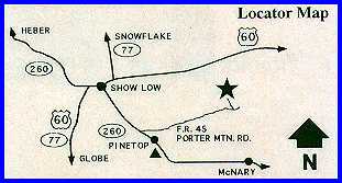
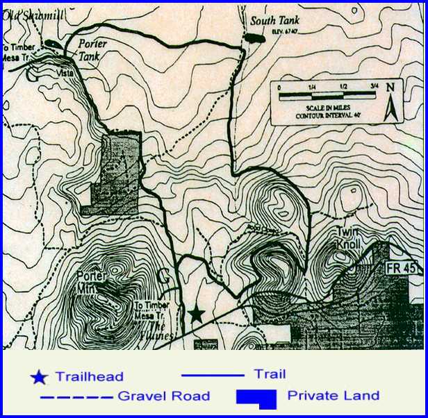
Attractions and Considerations: Panorama is a relatively level eight-mile trail of moderate difficulty. The long stretch of trail between the trailhead and Porter Tank is a well-worn two track road. Most of the trail is narrow to medium-width and rocky. The trail begins along Forest Road 206. It then meanders through ponderosa pine and pinon-juniper woodland, passing by Porter and South Tanks. There are excellent views of the surrounding countryside and on a clear day, as far away as Flagstaff's San Francisco Peaks. A climb to either one of the Twin Knolls will also be rewarded with excellent scenic views. Access: Access and trailhead location: From Lakeside Ranger Station drive .2 miles on AZ 260 towards McNary. Turn left on Porter Mountain Road (FR 45). Drive 6.0 miles towards Vernon. Trailhead is on Forest Road 206.
For more information, please feel free to contact:
|
||||||||||